-

Furuno Thru-Hull Side-Scan Transducer 12-Pin f/TZtouch3 12, 16 & 19 Models
Special Price $817.78 Regular Price $900.00 -
WHAT ARE MARINE NAVIGATION TOOLS AND WHY ARE THEY IMPORTANT?
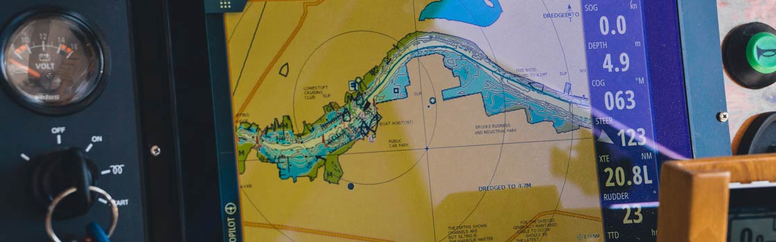
Marine navigation tools are instruments and equipment used on boats and ships to aid in navigation and navigational safety. These tools help the operator of the vessel to determine their position, track their course, and plan their route. Some examples of marine navigation tools include GPS systems, compasses, charts, and radar. They are incredibly important, especially in unfamiliar waters, because they help the operator of the vessel to navigate safely and efficiently, and to avoid hazards such as rocks, shallow waters, and other boats.
WHAT ARE THE COMMON TYPES OF MARINE NAVIGATION TOOLS?
When it comes to finding the right marine navigation tools for your boat, it’s important to know what’s available to you. Here are a few of the most commonly used marine navigation tools:
- GPS systems: use satellite technology to determine the vessel's position and track its movement
- Compasses: provide a heading or direction of the vessel
- Charts: provide information about the water depth, hazards, and navigational aids
- Radar: detect other boats, land masses, and hazards in the vicinity of the vessel
- Autopilot: computerized systems that keep the boat on a set course
- Echo-sounder: measure the depth of water beneath the boat
HOW DO MARINE NAVIGATION TOOLS WORK?
Marine navigation tools work in different ways depending on the type of tool. GPS systems use satellite technology to determine the vessel's position and track its movement. Compasses use magnetic fields to determine direction. Charts are used to plan a route and provide information about hazards and navigational aids. Radar uses radio waves to detect other boats and obstacles in the vicinity of the vessel. Autopilots use GPS and other navigational data to keep the boat on a set course. Echo-sounders use sound waves to measure the depth of water beneath the boat.
DO I NEED MARINE NAVIGATION TOOLS ON MY BOAT?
Whether or not you need marine navigation tools on your boat depends on the type and size of your vessel, as well as your intended use for the boat. Marine navigation tools can provide valuable information to help you navigate safely and efficiently, and can help you make informed decisions about the operation of your vessel. However, they are not necessary for all boats or all types of boating.
If you have a small, simple boat that is primarily used for recreational purposes in a familiar area, you may not need advanced marine navigation tools. However, if you have a larger, more complex vessel that is used for commercial or high-performance applications, marine navigation tools can be essential for determining your position, tracking your course, and avoiding hazards. If you are planning to navigate in unfamiliar waters, or in areas with a lot of boat traffic, marine navigation tools can be crucial for your safety and the safety of your crew and passengers.
Ultimately, the decision of whether or not to install marine navigation tools on your boat will depend on your individual needs and preferences. If you are unsure about whether or not you need marine navigation tools, it may be helpful to consult with a professional or speak with other boaters with similar vessels.
HOW DO I MAINTAIN AND TROUBLESHOOT MARINE NAVIGATION?
To maintain marine navigation tools, it's important to keep them clean and free of debris. This can be done by wiping them down regularly with a damp cloth and occasionally using a mild soap solution. It's also important to check the wiring and connections for signs of wear or damage, and to ensure that the tools are securely attached to the appropriate systems on the boat.
If a tool is not working properly, the first step in troubleshooting is to check the wiring and connections to ensure that they are secure and free of damage. If the problem persists, the tool itself may be faulty and will need to be repaired or replaced.